Surveying Drones
.
|
Explore risk areas in detail with easy-to-operate personal drones
|
|
|
|
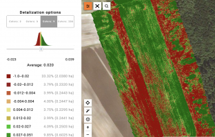
Drones allow analyzing crops in resolution up to 2cm per pixel by orthophoto map of fields. |
|
|
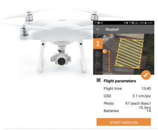
Mobile application for drone control – Aeroscouter – enormously simplifies data collection for non-professional pilots. . The whole process of data collection is fully automated. . Users can set field boundaries in advance in the cloud application. Aeroscouter builds the flight route over the field. . You just press the button “Start” in the Airscouter, and the drone takes off, runs the survey by the route, and lands automatically. |
|
|
An orthophoto is a crop canopy map assembled from drone images into orthogonal projection. . The process of orthophoto building is fully automatic. . Despite the significant processing capacity required for the production of such maps, you just need to download the drone photos in our cloud and launch the process to get ready-to-analyze orthophoto map. |
|
|
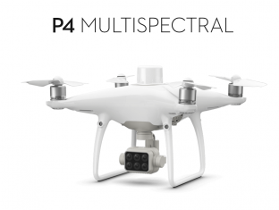
Our system is drone agnostic. There is only one requirement for photos: it should be GPS tagged. . But we recommend DJI Multispectral P4 for surveying fields and obtaining a wide range of vegetation indices. . Technical Specifications: -Maximum flight time: 27 minutes-Maximum coverage area at an altitude of 180m and a resolution of 10 cm per pixel per flight: 63 hectares-Five multispectral channel cameras: Blue, Green, Red Edge, Near-infrared-10 cm vertical and horizontal accuracy . |
|
|
Compact multispectral cameras allow you to build a wide range of vegetation indices, including NDVI, VARI, GNDVI, NDWI, SAVI, NDRE, etc. . . |
|
|
It is possible to generate pseudo-vegetation indices even with a visual camera: pseudo-NDVI, VARI, and so on. |
.
Field Studies
.
|
Our mobile application – Groundscouter – turns your smartphone into a professional tool |
|
|
|
Set Points of Inspection (POIs) in a cloud application for further use ones in smartphone application |
|
|
Groundscouter allows you to collect images and preset indicators by POIs . Offline mode: the ability to collect data in a field without Internet coverage with further synchronization of information with the cloud |
|
|
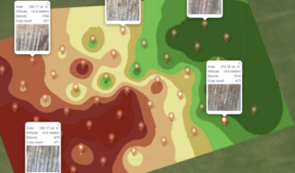
Building of interpolation maps based on the collected indicators at POIs |
.
